

Mgahinga Gorilla National Park is a small protected area in southwestern Uganda, located in Kisoro District near the borders of Rwanda and the Democratic Republic of Congo. It covers about 33.7 square kilometres which makes it Uganda’s smallest national park.
The park is part of the Virunga Conservation Area, a larger mountain ecosystem shared by Uganda, Rwanda and the Democratic Republic of Congo. It protects part of the Virunga volcanic mountain range and its surrounding forests.
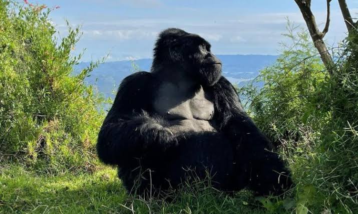
Three volcanoes are found within the Ugandan section of the Virunga Mountains which includes Mount Muhabura, Mount Gahinga and Mount Sabyinyo. Mount Muhabura is the highest rising to about 4,127 metres above sea level.
The name Mgahinga comes from Mount Gahinga, one of the volcanoes in the park. According to the Uganda Wildlife Authority, Gahinga is a local word referring to piles of volcanic stones cleared from farmland. Farmers would collect stones removed from their fields into piles which were known as gahinga.
History of Mgahinga Gorilla National Park
Before formal conservation began, the forests around Mgahinga were used by local communities including the Batwa who depended on the forest for hunting, gathering plants and other resources. Farming and settlement also took place around the mountains. In 1930, the area was established as a gorilla sanctuary under the British colonial administration. The main purpose was to protect mountain gorillas from hunting and protect their forest habitat. The area was later upgraded to a game reserve in 1964, giving it wider protection for wildlife and natural resources.
Mgahinga was officially gazetted as a national park in 1991. The creation of the national park also changed how neighbouring communities could use the forest. People who had been living or farming within the protected area were required to leave. Over time, conservation authorities increased efforts to involve neighbouring communities in conservation and tourism activities.
Mgahinga is part of the Virunga Conservation Area together with Volcanoes National Park in Rwanda and Virunga National Park in the Democratic Republic of Congo. Mgahinga was added to Uganda’s UNESCO World Heritage Tentative List in 2007 because of its natural and conservation importance. It is not, however, currently listed as a UNESCO World Heritage Site. Today, Mgahinga Gorilla National Park is managed by the Uganda Wildlife Authority.
Flora of Mgahinga Gorilla National Park
Mgahinga Gorilla National Park has different types of vegetation because its land rises from the lower mountain slopes to high volcanic peaks. The main vegetation zones include afromontane forest, bamboo, Hagenia-Hypericum woodland and afro-alpine vegetation. The lower slopes contain montane forest with trees, shrubs, herbs, mosses and lichens. Higher up, the forest changes into bamboo forests mainly made up of Arundinaria alpina. Bamboo is an important food source for mountain gorillas and provides habitat for other forest species. Above the bamboo zone is the Hagenia-Hypericum belt where plants are adapted to cooler mountain conditions.
At the highest elevations, vegetation becomes shorter and more specialized. Giant lobelias and giant groundsels (Senecio) are among the characteristic plants of the afro-alpine zone. These plants can withstand the cold conditions found near the mountain summits. Forest plants, bamboo, shrubs and herbs provide food and shelter for mountain gorillas, golden monkeys, birds and smaller animals. The forests also help protect water sources and reduce soil erosion on the steep volcanic slopes.
Fauna in Mgahinga Gorilla National Park
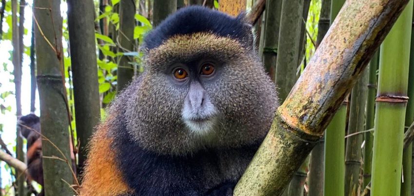
Mgahinga Gorilla National Park supports over 39 mammal species, however the park is known for mountain gorillas which live in the forest and bamboo areas. It is also home to the endangered golden monkey, a primate found only in the Virunga region. Other primates include blue monkeys and black-and-white colobus monkeys.
Other mammals recorded in the park include elephants, buffaloes, giant forest hogs, bushbucks, bushpigs, black-fronted duikers and leopards. Smaller carnivores including servals, side-striped jackals and spotted hyenas also occur in the area although many are rarely seen. The park hosts over 180 bird species including 14 Albertine Rift endemics. Some of these birds include the Rwenzori turaco, Rwenzori batis, handsome francolin, Kivu ground thrush and red-faced woodland warbler.
Activities in Mgahinga Gorilla National Park
Mgahinga Gorilla National Park offers several activities and they include gorilla trekking, golden monkey tracking, climb volcanoes, bird watching, nature walks and learn about the history of the Batwa people.
Gorilla trekking
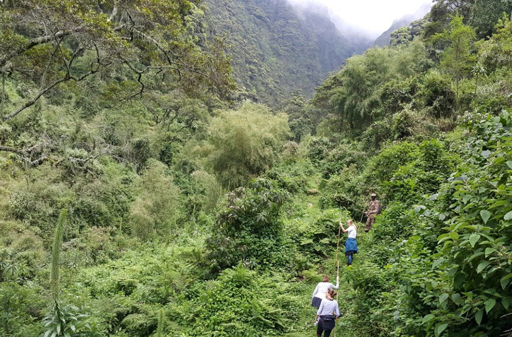
Gorilla trekking is a popular activity in Mgahinga Gorilla National Park. The park is home to a habituated Nyakagezi gorilla group that can be visited by tourists under the guidance of trained rangers. The trek starts with a briefing at the park headquarters before visitors enter the forest. Rangers lead the group along established trails and look for signs showing where the gorillas have moved. These signs may include feeding sites, footprints, broken vegetation and gorilla nests.
The time spent looking for the gorillas varies because the animals move through the forest. Once the group is located, visitors observe the gorillas while following the rules given by the guides and rangers. These rules help reduce disturbance and protect the animals from human-related diseases. Gorilla trekking can take several hours depending on where the gorilla group is located. Visitors therefore need suitable walking shoes, drinking water and clothing that can handle wet and muddy forest conditions.
Golden monkey tracking
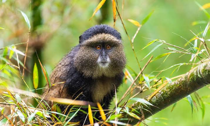
Golden monkey tracking is another popular activity in Mgahinga. The golden monkey is native to the Albertine Rift and is mainly found in the Virunga region. The activity involves walking through the forest and bamboo zones with guides in search of habituated golden monkey groups. The monkeys are active and can move quickly through the bamboo and trees so visitors may need to follow them for some distance.
The activity gives visitors an opportunity to observe their feeding and social behaviour. It also provides information about the habitat that supports this endangered primate. Mgahinga also offers a golden monkey habituation experience which allows visitors to spend more time observing the animals while learning about their behaviour and conservation.
Hiking the Virunga Volcanoes
Mgahinga contains three of the Virunga volcanoes Mount Muhabura, Mount Gahinga and Mount Sabyinyo. Each mountain offers a different hiking experience.
Mount Muhabura
Mount Muhabura rises to about 4,127 metres and is the highest of the three volcanoes found in Mgahinga. The hike involves a steep climb through different vegetation zones. At the summit, hikers can find a small crater lake and when weather conditions allow, views of other Virunga volcanoes. The hike is physically demanding because of the altitude and steep terrain.
Mount Gahinga
Mount Gahinga stands at about 3,474 metres. The trail passes through bamboo forests and higher-altitude vegetation. The name Gahinga is associated with the local word for a pile of stones. The name refers to the piles of volcanic stones that farmers traditionally cleared from their fields. The hike is shorter than the climb of Mount Muhabura but still requires reasonable fitness.
Mount Sabyinyo
Mount Sabyinyo reaches about 3,669 metres. Its trail becomes more difficult towards the summit where hikers negotiate steep and narrow sections. One of the main features of the hike is the opportunity to stand near the point where Uganda, Rwanda and the Democratic Republic of Congo meet. Mountain hikes are guided and weather conditions can change quickly at higher elevations. Hikers should therefore follow instructions from their guides and carry appropriate clothing.
Batwa cultural experience
The Batwa cultural experience focuses on the history and traditional knowledge of people who lived in the forests around Mgahinga. The Batwa traditionally depended on the forest for hunting, gathering food, collecting medicinal plants and obtaining materials for daily use. Their relationship with the forest changed when the area became protected and human settlement and resource use were restricted.
During a cultural visit, Batwa guides explain aspects of their former forest life. Visitors may learn about traditional hunting methods, medicinal plants, food gathering and the use of forest resources. The experience can also include a visit to Garama Cave which is associated with the Batwa.
Bird watching
Mgahinga is also suitable for bird watching because it forms part of the Albertine Rift, an area known for its bird diversity and species with restricted ranges. The park hosts over 89 bird species and some of them include Rwenzori turaco, Rwenzori batis, handsome francolin, Kivu ground thrush and red-faced woodland warbler.
Bird watching is usually done along forest trails. Visitors walk slowly with a guide while looking and listening for birds in the trees, bamboo, shrubs and forest floor. Some birds may be difficult to see because of the thick vegetation, so identifying them by their calls is an important part of forest birding. Bird watching can be arranged as a separate activity or combined with a nature walk or another forest excursion.
Nature walks
Nature walks provide a less specialized way of exploring Mgahinga. They allow visitors to learn about the forest, plants, birds and smaller wildlife without focusing on a particular animal. The walks are guided and the pace is usually slower than a gorilla or golden monkey trek. Guides can explain the different vegetation zones and point out signs of animals along the trail. For example, visitors may come across animal tracks, feeding marks, insects or birds that would easily be missed during a faster walk.
Gorge walk
The Gorge Walk takes visitors through a section of the park between Mount Gahinga and Mount Sabyinyo. It provides an opportunity to observe the volcanic landscape and vegetation without undertaking a full mountain climb. The walk passes through different vegetation and can provide opportunities for bird watching. It is suitable for visitors who want to explore the park on foot but do not want the physical demands of climbing one of the volcanoes.
Community and cultural visits
Activities around Mgahinga can also include interaction with communities living near the park. These visits provide information about local livelihoods, crafts, farming and the relationship between communities and the protected area. Such experiences can complement gorilla trekking because they show that conservation takes place alongside communities rather than only inside the park. Visitors should use organised community experiences and follow local guidance during these visits.
Best time to visit Mgahinga Gorilla National Park
Mgahinga Gorilla National Park is open to visitors throughout the year. The drier months of June to August and December to February are generally preferred for gorilla trekking, golden monkey tracking and volcano hiking because trails are usually less muddy.
The wetter months of March to May and September to November can bring heavier rainfall and slippery trails. However, trekking continues during these periods and visitors may encounter fewer tourists. Because Mgahinga is a high-altitude mountain park, rain can occur at any time of the year. Travellers should carry waterproof clothing and sturdy hiking shoes regardless of their travel dates.
How to access Mgahinga Gorilla National Park
Mgahinga Gorilla National Park is in southwestern Uganda near Kisoro and the borders with Rwanda and the Democratic Republic of Congo. The main entrance and park headquarters are at Ntebeko.
By Road
Road travel is the main way to reach Mgahinga. From Kampala, the journey is about 524 kilometres and passes through Mbarara, Kabale and Kisoro. From Kabale, the road continues for about 80 kilometres to Kisoro. This section passes through mountainous terrain and has several winding sections.
From Kisoro, it is about 14 kilometres to Ntebeko where visitors report for park activities. The final road to the park can be rough particularly during rainy weather. A 4-wheel-drive vehicle is therefore useful for this section. Visitors travelling by public transport can take a bus or taxi to Kisoro and arrange transport from there to the park.
By Air
Travellers who want to reduce the long road journey can fly from Entebbe International Airport or Kajjansi Airfield to Kisoro Airstrip. The flight takes roughly one hour and ten minutes, depending on the flight schedule and conditions.
From Kisoro Airstrip, visitors continue by road to their lodge or Mgahinga Gorilla National Park. There are no direct flights into the park itself.
From Rwanda
Mgahinga’s location near Rwanda also allows it to be included in a Uganda-Rwanda safari. Travelers entering Uganda from Rwanda can cross through the Cyanika border point and continue to Kisoro by road. By road it takes 4-5 hours drive including time spent on immigration office.